MOE Multivariate Optimization via REST
Oct 30, 2017Using MOE to Optimize in Two Dimensions
Have you ever suddenly realized that you’ve spent more time than you planned tweaking the hyperparameters of a complex neural network? Wouldn’t it be nice to let software figure it out? Not just with an exhaustive grid search, but in a smart way.
It has been done.
I noticed a great blog post on a subject I’ve been meaning to get around to ever since Ryan Adams mentioned it on the Talking Machines podcast. I can’t find the episode right now, so here’s a paper: Practical Bayesian Optimization of Machine Learning Algorithms.
The blog post is here: Bayesian optimisation for smart hyperparameter search, by Tim Head, 2015.
It’s a great post. It explains how Gaussian Processes are good at guiding the search through the space of hyperparameter settings. But while it uses a Python package called george, it recommends another package for production use, namely MOE.
I wanted to use MOE, but it recommended docker, and I hadn’t yet decided to drink that Koolaid. Recently I consumed a few pitchers of docker Koolaid, though, so I ran the MOE docker container and had a REST server on localhost port 6543.
sudo docker pull yelpmoe/latest
sudo docker run -p 6543:6543 yelpmoe/latest
Pretty Endpoints
MOE has a C++-based optimizer that is exposed via a Python-based REST API server. The API comes with an interesting feature, pretty endpoints. If there’s an endpoint, /foo, then you can visit /foo/pretty in your web browser and see an interactive example. The page has example JSON that you can submit, edit, and resubmit.
It’s pretty cool, but it left me wishing for a more traditional API reference when I wanted to go from a one-dimensional search to a two-dimensional search.
The REST client that comes with MOE is pretty well documented, so I ran another copy of the MOE container.
sudo docker run -it -u root -v ~/experimental/moe-user:/mnt --entrypoint=/bin/bash yelpmoe/latestIn there, I hacked the Python REST client to log its JSON messages to a file in /tmp and examined that when running the example 2D search that comes with MOE. Then I saw the format I had to use.
{"domain_info": {"dim": 2, "domain_bounds": [{"max": 5.0, "min": -5.0}, {"max": 5.0, "min": -5.0}]}, "gp_historical_info": {"points_sampled": []}, "num_to_sample": 1}I already guessed that you have to say that "dim" is 2, but I noticed that you also have to provide a min and max pair for each dimension.
Something to Optimize
I wanted to have a function with local minima and a global minimum, so I added a cosine to a parabola.
library(ggplot2)

true.fn <- function(x) {
    d <- sqrt(sum(x^2))
    y1 <- d^2 / 100
    y2 <- cos(d) / -4
    (y1 + y2)
}

grid <- function(x, y) {
    m <- matrix(nrow=length(x) * length(y), ncol=2)
    rowi <- 1
    for (i in 1:length(x)) {
        for (j in 1:length(y)) {
            m[rowi,] <- c(x[i], y[j])
            rowi <- rowi + 1
        }
    }
    m
}

domain <- function() {
    x <- seq(-20, 20, by=0.5)
    y <- x
    grid(x, y)
}

mk.data <- function() {
    m <- domain()
    m <- cbind(m, apply(m, 1, true.fn))
    colnames(m) <- c("x", "y", "z")
    data.frame(m)
}

show <- function() {
    ggplot(mk.data(), aes(x=x, y=y, z=z)) + geom_contour()
}

show.x <- function() {
    d <- mk.data()
    ggplot(d[d$y == 0,], aes(x=x, y=z)) + geom_line()
}

show.x()
It’s easier to see in one dimension, but it’s a two-dimensional function.
show()
Any Client
Now I wanted to try out MOE from Python but without using their Python library. It sounds odd, but consider that 1) I might want to use some other language, maybe one that isn’t out yet, and 2) I have been using Python 3 preferentially, and their Python REST client libraries seem more comfortable with Python 2.7.
Here’s the code that uses JSON directly.
#! /usr/bin/env python2.7

from __future__ import print_function

import json
import math
import os
import requests

from addict import Dict
import click
import numpy as np


API = 'http://localhost:6543/gp/next_points/epi'


def true_fn(point):
    d = np.sqrt(
        pow(np.array(point, dtype=np.float32), 2).sum())
    y1 = pow(d, 2) / 100
    y2 = math.cos(d) / -4
    return y1 + y2


@click.option(
    '--max-iter', default=3
)
@click.option(
    '--verbose', default=False, is_flag=True
)
@click.command()
def main(max_iter, verbose):
    exp = Dict({
        "domain_info": {
            "dim": 2,
            "domain_bounds": [
                {"max": 20.0, "min": -20.0},
                {"max": 20.0, "min": -20.0},
            ]
        },
        "gp_historical_info": {
            "points_sampled": [],
        },
        "num_to_sample": 1,
    })
    best_point = None
    best_val = None
    for i in range(max_iter):
        if verbose:
            print(json.dumps(exp))
        r = requests.post(API, data=json.dumps(exp))
        if verbose:
            print(r.text)
        nextpt = [float(i)
                  for i in json.loads(
                          r.text)['points_to_sample'][0]]
        val = true_fn(nextpt)

        s = ''
        if best_point is None or val < best_val:
            best_point = nextpt
            best_val = val
            s = '  ... A WORLD RECORD!!!'

        print('f({}) = {}{}'.format(nextpt, val, s))

        exp.gp_historical_info.points_sampled.append({
            "value_var": 0.01,
            "value": val,
            "point": nextpt,
        })


if __name__ == '__main__':
    main()
Yeah, yeah. I know—I used Python 2.7 right after I said I prefer Python 3. Call me a hypocrite. The point is that anything can print JSON.
The output looks something like this:
ecashin@montgomery:~/experimental/moe-user$ ./useapi_2d.py --max-iter 20
f([-19.4211329705, 16.1817903783]) = 6.14297928492  ... A WORLD RECORD!!!
f([-10.1536519406, -14.1447713031]) = 2.99854690833  ... A WORLD RECORD!!!
f([-4.08891069113, -7.77026636892]) = 0.970837639895  ... A WORLD RECORD!!!
f([7.89655712959, -16.2536583322]) = 3.0875048342
f([0.557183035696, 0.089724831252]) = -0.208047592448  ... A WORLD RECORD!!!
f([-1.17069715023, 0.183623456291]) = -0.0800293795817
f([-0.0212410306582, -1.56499600174]) = 0.023082594082
f([0.225741656362, 1.78274736612]) = 0.0883571884112
f([2.30178362082, 0.260580016253]) = 0.223280866099
f([-3.75559521582, -1.26936274927]) = 0.327215201349
f([1.07484307288, 13.7023252526]) = 1.79340747812
f([12.1463972019, 12.6231103474]) = 3.0095546387
f([19.2194897527, 3.76973996397]) = 3.65073229955
f([18.9615251931, -12.2498296432]) = 5.30466432742
f([-13.0612450007, 5.59698062173]) = 2.03739960908
f([-8.39848964969, 14.0978753142]) = 2.88374592401
f([-18.7357357443, -11.5192903881]) = 5.08721754187
f([17.4818277491, 19.9567035878]) = 6.99587824901
f([-2.03383613494, -18.024251427]) = 3.1006606068
f([7.36148447862, -7.24269082653]) = 1.2214368028
ecashin@montgomery:~/experimental/moe-user$
If I increase the number of iterations, I can see that MOE jumps around a lot in the little box from \((-20, -20)\) to \((20, 20)\). It quickly finds some pretty good points but then spends a lot of time trying different combinations of coordinates.
If I change the output to CSV, I can plot the search by using gganimate for the first time ever.
library(dplyr)
##
## Attaching package: 'dplyr'
## The following objects are masked from 'package:stats':
##
##     filter, lag
## The following objects are masked from 'package:base':
##
##     intersect, setdiff, setequal, union
library(ggplot2)
library(gganimate)

d <- read.csv('search.csv', header=TRUE)
p <- ggplot(d, aes(x=x1, y=x2, frame=iter, label=iter, cumulative=TRUE)) +
  geom_text()
Then I call gganimate() to get the gif below.
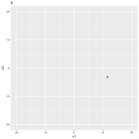
search sequence
I think that it has to explore all the gaps because I intentionally made the search hard.
Easier Optimization
If I modify the true function to remove the bumps, leaving only a parabola, the optimizer has an easier job to do.
def true_fn(point):
    d = np.sqrt(
        pow(np.array(point, dtype=np.float32), 2).sum())
    y1 = pow(d, 2) / 100
    # y2 = math.cos(d) / -4
    return y1 #  + y2
Running the optimizer one hundred times, I get search-easy.csv, and I recreate the gganimate plot below.
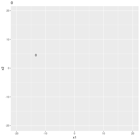
easier search sequence
It looks like it still doesn’t trust the easy answer. If it was just descending the gradient it would just shoot right on down the hill to the origin, but it’s skeptical, like it doesn’t want to miss a little unexpected minimum in a less well expored part of the manifold.
Scaling Up
The whole point is that the function is expensive to evaluate, so it isn’t that big a deal if there’s some latency going through REST. Still, I want to get some idea of how many dimensions I can expect to use with a “reasonable” query time, and how many points I can add before things get unwieldy.
I go to 100 points for each of 4, 8, 16, \(...\), 512 dimensions. For each iteration, a point is added to the historical information, and the query time in milliseconds is reporting.
The plot below is surprising. Four dimensions is very slow (as was two); however, higher numbers of dimensions enjoy quicker queries. Maybe MOE switches strategies for higher numbers of dimensions.
d <- read.csv("scale-up.csv", header=TRUE) %>% mutate(ndim=factor(ndim))
ggplot(d, aes(x=iter, y=query_msecs, color=ndim)) + geom_point()
The final version of the Python script is shown below.
#! /usr/bin/env python2.7

from __future__ import print_function

import json
import math
import os
import requests
import time

from addict import Dict
import click
import numpy as np


API = 'http://localhost:6543/gp/next_points/epi'


def true_fn(point):
    d = np.sqrt(
        pow(np.array(point, dtype=np.float32), 2).sum())
    y1 = pow(d, 2) / 100
    y2 = math.cos(d) / -4
    return y1 + y2


@click.option(
    '--max-iter', default=3
)
@click.option(
    '--verbose', default=False, is_flag=True
)
@click.option(
    '--n-dim', default=2
)
@click.command()
def main(max_iter, verbose, n_dim):
    exp = Dict({
        "domain_info": {
            "dim": n_dim,
            "domain_bounds": []
        },
        "gp_historical_info": {
            "points_sampled": [],
        },
        "num_to_sample": 1,
    })
    for _ in range(n_dim):
        exp.domain_info.domain_bounds.append(
            {"max": 20.0, "min": -20.0})
    best_point = None
    best_val = None

    print('iter,ndim,query_msecs')

    for iter in range(max_iter):
        if verbose:
            print(json.dumps(exp))
        start = time.time()
        r = requests.post(API, data=json.dumps(exp))
        query_msecs = (time.time() - start) * 1000

        if verbose:
            print(r.text)
        nextpt = [float(i)
                  for i in json.loads(
                          r.text)['points_to_sample'][0]]
        val = true_fn(nextpt)

        if best_point is None or val < best_val:
            best_point = nextpt
            best_val = val

        print('{},{},{}'.format(
            iter,
            n_dim,
            query_msecs))

        exp.gp_historical_info.points_sampled.append({
            "value_var": 0.01,
            "value": val,
            "point": nextpt,
        })


if __name__ == '__main__':
    main()